Where Is Mayon Volcano? Albay Province, with Legazpi City at Its Foot
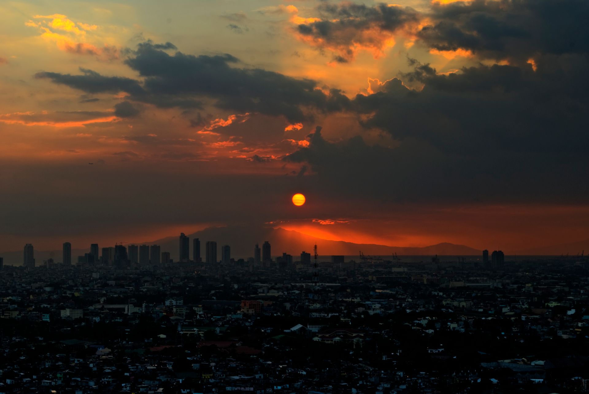
Mayon Volcano is in Albay province in the Bicol Region, at the southeastern end of Luzon. Legazpi City, the provincial capital at its foot, is the usual base, and on a clear day you can see the whole cone from the city streets. Legazpi is also the practical hub for Bicolano food and for trips around the province.
Mayon is famous for two things. The first is its shape: the official websites of both Legazpi City and the municipality of Daraga introduce it as the world's most perfect cone, close to symmetrical from most directions. The second is how active it is. The eruption history kept by the Philippine Institute of Volcanology and Seismology (PHIVOLCS) numbers the current episode as Mayon's 55th recorded eruption. It began on January 6, 2026 with the growth and collapse of a summit lava dome that generated pyroclastic density currents; lava flows followed from January 12, and PHIVOLCS lists the eruption as ongoing.
The deadliest eruption on record came on February 1, 1814. PHIVOLCS lists it as Mayon's most destructive, affecting Camalig, Cagsaua, Budiao, Guinobatan and half of Albay, with about 1,200 casualties. The ruined Cagsawa church that visitors photograph today is a direct legacy of that day; see section 3.
The area is also protected. The schedule of Republic Act No. 11038, the Expanded NIPAS Act signed in 2018, lists a Mayon protected area in Albay as item 36, covering 5,327.15 hectares. Because towns and farms surround the volcano, safety here is managed mainly by keeping people out of danger zones rather than by closing the whole mountain.
If you are still deciding whether Mayon is worth the detour, compare it with other highlights in our guide to the top attractions in the Philippines. For a volcano view much closer to Manila, Taal from the Tagaytay ridge is covered in our Tagaytay day trip guide. The two make an interesting contrast: Taal is a volcano in a lake, while Mayon is a lone cone rising almost straight out of the coastal plain.
How to Get to Mayon Volcano: Fly to Bicol International Airport, or Plan a Long Day by Road
From Manila, the fastest way to Mayon is a flight of roughly 1 hour to Bicol International Airport in Daraga, Albay, a short drive from both downtown Legazpi and the Cagsawa Ruins. By road, expect most of a day or longer.
According to Philippine News Agency reports on the Department of Transportation's opening plans, Bicol International Airport began commercial operations in October 2021 and replaced the old Legazpi domestic airport. When you search for flights, choose this airport rather than an outdated "Legazpi Airport" listing from an old guide. Schedules and frequencies change, so check with the airlines; for booking tactics see how to find cheaper flights in the Philippines, and for luggage limits on domestic routes see domestic flight baggage rules.
By road, you drive or take a long-distance bus south from Metro Manila through a long chain of towns. The actual time depends heavily on when you leave and on traffic, and it usually takes most of a day or more. That suits travellers with time who want to stop along the way. With older relatives or small children, flying is the obvious choice.
Where to stay once you arrive:
- Downtown Legazpi. The easiest base for food, shops and money changers, close to Lignon Hill and the waterfront, and the default choice for a first visit.
- Around Daraga. Closer to the airport, the Cagsawa Ruins and Daraga Church, and handy if you are staying only 1 or 2 nights purely to see the volcano.
Local transport is mostly taxis, tricycles and jeepneys. The viewpoints are spread between Legazpi and neighbouring towns, so if you want to see 3 or 4 of them in a day, a car with a driver saves a lot of effort. Remember too that ash affects flying. PHIVOLCS bulletins routinely recommend that aircraft not fly close to the volcano, and during active phases flights may be rescheduled or cancelled, so choose flexible bookings where you can.
Want your Manila flights, Legazpi hotel and a car for the viewpoints planned together? → Yixing custom itineraries · car with driver
Where to See Mayon Volcano: Cagsawa Ruins, Lignon Hill, Daraga and the Waterfront
You do not need to get close to see Mayon. The four classic viewing spots are all outside the danger zone: the Cagsawa Ruins in Daraga, Lignon Hill in Legazpi, the area around Daraga Church, and the Legazpi waterfront. Early morning usually has the fewest clouds and the best chance of a clear cone; by afternoon the summit is often hidden.
- Cagsawa Ruins (Daraga). According to the Daraga municipal website, these are the remains of a 16th-century Franciscan church destroyed by the 1814 eruption, and the surviving bell tower is now one of the most iconic landmarks in Bicol. The National Museum of the Philippines identifies the ruins as a National Cultural Treasure and runs its Bicol museum right beside them in Busay, Daraga, with exhibitions on the region's geological landscapes and the marvels of Mayon. Visit both together to understand how the volcano reshaped this land.
- Lignon Hill (Legazpi). The Legazpi City website highlights the 360-degree view of the city from the hilltop view deck. On a clear evening you get the city and the bay on one side and Mayon on the other.
- Daraga Church (Our Lady of the Gate Parish Church). The municipality describes it as a National Cultural Treasure known for its distinctive Baroque architecture and fine detailing. Daraga sits close to the volcano, so on a clear day Mayon is in view from around the church. Dress modestly and check Mass times before going inside.
- Legazpi waterfront. Open spaces along the city's shore give a view of the volcano without any climbing, which makes for an easy early-morning walk.
The spots are close enough to cover 3 or 4 in a day: Cagsawa at dawn, the museum and Daraga Church in the morning, a rest in the city after lunch and Lignon Hill at sunset. The provincial government has also been setting up dedicated volcano viewing sites in recent years; for new locations and access, follow the current announcements of the province and the host towns.
If reading landscapes is your kind of travel, the Chocolate Hills in Bohol show a completely different, limestone side of Philippine geology and make a good next trip.
Is Mayon Volcano Erupting? How to Check the Alert Level and What Each Level Means
For Mayon's current status, rely on one source: the daily bulletins of PHIVOLCS. The 24-hour observation bulletin issued at midnight on September 17, 2026 placed Mayon at Alert Level 2, labelled "Decreased Unrest," and recommended no entry into the 6-kilometre-radius Permanent Danger Zone (PDZ) and no flying of aircraft close to the volcano.
Some context on this episode. PHIVOLCS raised Mayon from Alert Level 2 to Alert Level 3 on January 6, 2026, as the summit lava dome began collapsing, and recommended evacuating residents inside the danger zone; its eruption history lists the activity that began that day as eruption number 55, still ongoing. By September the level had been lowered to 2, but the same bulletin still warns of 3 possible hazards: sudden steam-driven (phreatic) eruptions, rockfalls or landslides, and lahars during heavy and prolonged rainfall.
PHIVOLCS uses a Mayon-specific scale from 0 to 5. The points that matter for visitors:
- Level 0. Parameters at background, but entering the 6-km PDZ is still not advised because phreatic explosions and ash puffs can happen without warning.
- Level 1. Low-level unrest; no entry into the 6-km PDZ.
- Level 2. Moderate unrest; the danger zone may be extended to 7 km on the sector where the crater rim is low.
- Level 3. Relatively high unrest; an eruption is possible within weeks, and extending the danger zone on the low-rim sector will be considered.
- Level 4. A hazardous eruption is possible within days; extension to 8 km or more on the low-rim sector will be recommended.
- Level 5. A hazardous eruption is under way, with pyroclastic flows, tall eruption columns and widespread ashfall; more danger areas may be declared.
Where to check: the PHIVOLCS alert level page explains the scale, and the daily bulletins are on the PHIVOLCS bulletin list in English and Filipino, with each monitored volcano's current level shown at the top of the page. Check when you book, the day before you travel and the morning you head out. If the level goes up, local government evacuation orders and road closures override any plan.
Worried a change in alert level could upend your plans? → Yixing custom itineraries
Mayon Volcano Safety: Stay Out of the PDZ, Away from Rivers in Rain, and Indoors in Ashfall
Mayon's safety rules boil down to one sentence: never enter the 6-kilometre Permanent Danger Zone at any alert level, keep away from river channels draining the volcano during heavy rain, and mask up, close the windows and pause your plans if ash starts to fall. All of this comes from PHIVOLCS bulletins and alert level guidance; none of it is over-cautious padding.
- Stay out of the PDZ. Entry is not advised even at Level 0 and is prohibited from Level 1, and from Level 2 the zone may be widened on the low-rim side. Social media clips of people getting "as close to the lava as possible" were often filmed inside the danger zone. Do not copy them.
- Respect lahars. PHIVOLCS notes that intense rainfall over the volcano can generate lahars that reach riverside communities far beyond the PDZ. Bicol gets heavy rain in the wet and typhoon seasons, so on rainy days do not linger beside or wade across channels coming off the mountain. For booking changes, see how to handle typhoon cancellations.
- If ash falls. Wear an N95-grade mask and eye protection, swap contact lenses for glasses and close the car windows. Ash on the road is slippery, so stop driving.
- ATV and off-road rides. Local operators run rides across old lava terrain. Before joining, confirm the route is outside the danger zone, that the local government allows operations that day, and that helmets and insurance are provided. These activities are suspended when the level rises; follow local government notices.
- Drones. PHIVOLCS recommends that aircraft not fly near the volcano. Whether and where drones may fly is up to the civil aviation and local authorities; if in doubt, keep yours packed.
- The summit. Mayon is not a tourist climb. The entire upper mountain lies inside the danger zone, so turn down any offer to "take you up."
Two more habits help. Tell your companions or your hotel where you are going each day, and if the local government issues an evacuation or road closure, comply instead of heading back for one more photo. Check whether your travel insurance covers cancellations caused by natural hazards. For a broader pre-trip checklist, see planning your first trip to the Philippines.
How Many Days for Mayon, and What to Eat in Bicol
For Mayon alone, 2 nights in Legazpi is enough: the first afternoon and the second morning each give you a chance at a clear view, with a fallback if the weather does not cooperate. To add Bicolano food and nearby towns, plan 3 days and 2 nights, or 4 days and 3 nights.
- Day 1. Land at Bicol International Airport before noon, check in, then visit the Cagsawa Ruins and the National Museum's Bicol branch next door. Head up Lignon Hill for sunset.
- Day 2. Be at the waterfront or another open spot by about 06:00 for the morning cone, visit Daraga Church in the late morning, and spend the afternoon on food and markets. Check the PHIVOLCS bulletin again before heading out.
- Day 3. Choose one: more volcano views and small towns within Albay, or a trip south to neighbouring Sorsogon, where seasonal whale shark interactions depend on the local government's current arrangements. Fly out in the afternoon.
Food is the other half of this trip. The Daraga municipal site sums up Bicolano cooking as spicy and rich in coconut milk. Look for Bicol Express, pork simmered in coconut milk with chillies; laing, taro leaves slow-cooked in coconut milk; and the many snacks and sweets made from locally grown pili nuts. If you prefer mild food, ask for "less spicy." For signature dishes from across the country, see our Filipino food must-try list.
Linking Mayon with other destinations: it usually works as a stand-alone trip of 2 to 3 nights in Bicol, flying in and out of Manila. To see several kinds of landscape in one journey, add the Chocolate Hills in Bohol or Davao and Mount Apo in Mindanao, usually connecting through Manila or Cebu. For weighing the wet and typhoon seasons, see the best months to visit the Philippines, and for quieter places in the same slow-travel spirit, see the Philippines' less-visited islands. Practical tasks after landing, such as a SIM card, currency exchange or a visa extension, can go to our settling-in services.
Want Mayon and a few islands combined into one route with no backtracking? → Yixing custom itineraries · all routes
Frequently Asked Questions
Where is Mayon Volcano?
Is Mayon Volcano erupting right now?
How do I check Mayon's alert level today?
Can you climb Mayon Volcano?
How do I get from Manila to Legazpi?
What is the best place to view Mayon Volcano?
How many days do you need for Mayon Volcano?
Let’s talk through your situation — free
Every company is different. Leave your details and a Chinese-speaking advisor will get back within 1 business day with practical, industry-specific guidance and a transparent quote.
Get help with Travel → Free consultation